
Deadly 7.7-Magnitude Earthquake Hits Indonesia, Thousands Flee as Buildings Collapse
A powerful magnitude 7.7 earthquake struck off the coast of Indonesia’s Flores island early Saturday morning, sending terrified villagers fleeing into the streets and causing widespread damage to buildings and infrastructure, according to the U.S. Geological Survey (USGS). The shallow undersea tremor, which hit just after 4:30 a.m. local time, was felt across the eastern archipelago, with residents reporting strong shaking that lasted nearly a minute.
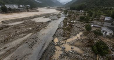
Indonesian authorities immediately scrambled to assess the devastation, as footage from the region showed cracked roads, collapsed houses, and panicked crowds gathering in open spaces away from the shoreline. The National Disaster Mitigation Agency (BNPB) confirmed that several villages on Flores and nearby islands sustained significant structural damage, though casualty figures remained unclear hours after the main shock. Rescue teams were deployed to the hardest-hit areas, with emergency medical personnel on standby as the agency warned the numbers of dead and injured could rise.
Villagers in Fear as Aftershocks Rattle Region
In the village of Larantuka and other coastal communities, residents described a sudden, violent jolt that threw furniture across rooms and cracked walls. Many fled their homes in darkness, fearing a repeat of the catastrophic 2018 Sulawesi earthquake and tsunami. “We ran outside immediately. Everyone was screaming,” one local told reporters by phone. “The ground would not stop shaking.”
The quake’s epicenter was located roughly 112 kilometers northwest of Maumere, the largest town on Flores, at a depth of just 18 kilometers (11 miles), a shallow profile that amplifies surface shaking and raises tsunami concerns. The Pacific Tsunami Warning Center (PTWC) issued an initial bulletin saying hazardous waves were possible within 1,000 kilometers of the epicenter, prompting local evacuation orders, but the advisory was later lifted after sea-level gauges showed no major tsunami generated.
Race to Find Survivors Amid Collapsed Structures
BNPB spokesman Abdul Muhari said search-and-rescue operations were focused on areas where buildings had crumbled, particularly older masonry structures that were not designed to withstand strong lateral forces. Telecommunications and electricity were disrupted in several districts, hampering early damage assessments. Ports and bridges suffered cracks, cutting off some communities from immediate aid.
“We are still compiling data from the field, but we expect the number of casualties to increase as teams reach more remote villages,” Muhari said. “This is a race against time, especially if aftershocks cause further collapses.” The agency has deployed military and police units to assist with evacuations and set up temporary shelters for those displaced.
Indonesia’s Unforgiving Seismic Reality
Flores and the surrounding Lesser Sunda Islands sit atop the volatile convergence of the Indo-Australian and Eurasian tectonic plates, part of the Pacific “Ring of Fire” that generates frequent and often deadly earthquakes. In 1992, a 7.8-magnitude quake and subsequent tsunami devastated the same region, killing more than 2,500 people. Saturday’s tremor struck on or near the same fault zone, a stark reminder of the area’s vulnerability.
Seismologists warned that strong aftershocks could persist for days or weeks, potentially threatening already weakened buildings. Residents were urged to stay away from the coast and to follow official channels for information.
As international monitoring agencies continued to analyze the data, Indonesia’s president ordered all relevant ministries to provide rapid assistance. The full scale of the disaster is expected to become clearer once daylight allowed aerial surveys and ground teams to reach isolated villages.